

Missouri River 340 Spectator’s Guide

Every summer, hundreds of paddlers follow the Missouri River along a 340 mile course from Kansas City to St. Charles in a 2-4 day test of dedication and endurance. It's fun and inspiring to watch paddlers along the course, but getting the best experience as a spectator requires understanding the race's structure and how opportunities change across the state.

Video guide
Our video guide offers a visual exploration of the race from a spectator's point of view, including:
Summary of race structure and timing
Advice for viewing in western, central, and eastern Missouri
Recommended sites and those to avoid
Race Overview
Animation of MR 340 racer positions during the 2024 race. Green marks solo boats, blue are tandems, red are larger crews.
The race is organized by Missouri River Relief, a fantastic non-profit that does extensive education, outreach, cleanup and other work along the river.
The race is typically scheduled within a four-day block in July or August, Tuesday to Friday, timed to coincide with a full moon to aid night-time paddling. Weather can force a change in schedule, so always check the official race site for updated information and other details of the race.
The 2025 race is scheduled for July 8–11!
Racers depart Kansas City in a dense pack early on Tuesday morning. A dedicated chaser vessel dubbed The Reaper follows the pack at the minimum speed required to meet defined checkpoints along the way. Elite racers push through 30-some hours of sleepless exertion to reach St. Charles by Wednesday evening, though the finish line stays open until Friday at 9 p.m.
Read on below for a more detailed exploration of the race from a spectator’s perspective!
Note: Ozark Outsider is independent of Missouri River Relief, though we've been personally involved in various of their programs and their race director approved the video above. Content we present here is our own, not official MRR or MR340 information. This content is for spectators; racers should consult the MR340 website for all guidance.
If you find this content interesting and useful, please consider leaving a tip to support our work as an independent small business. We accept tips through Ko-fi, a simple platform that allows one-time payments without an account, or you can subscribe to monthly support if you’re feeling generous.
Viewing guide by region
The race evolves through distinct forms as racers spread out over the state, so it's important to consider place, date, and time when setting out to watch. Consider using the RaceOwl app or website to track racer locations. Be sure to use the “RaceOwl” app (intended for ground crew and spectators) as opposed to the “RaceOwlRacer” app (intended for racers). From a spectator's perspective, we think it's most effective to consider the race in three geographic stages, as summarized below.
Below we offer quick summaries of viewing options by region, followed by a more detailed list describing specific suggested viewing locations.
What to bring
Wherever and however you watch, think ahead about what you might want. Lawn chairs, shade (umbrellas or tents), and binoculars can be very useful. Mosquitos often aren’t an issue, but can be problematic under the right (wrong?) circumstances. Consider snacks, drinks, and plenty of ice.

Western Missouri (Day 1, Tuesday)
Racers set out from Kaw Point (just upriver from Kansas City) in two pulses: 7:00 am for solo paddlers and 8:00 am for multi-person boats. Racers need to pass the Waverly checkpoint by the evening of Day 1.
The pack stays fairly tight this first day and will pass by most locations within a few-hour time window.
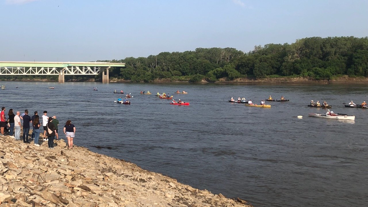
The best public viewing sites are near Kansas City
Avoid the busy starting area at Kaw Point.
Avoid downstream boat ramps on this busy first day as these tend to be clogged with support crews.
The stretch from Waverly to Miami is covered at night by most paddlers, so isn’t the best stretch to watch. Miami also has a reputation as a busy ramp.
Central Missouri (Day 2, Wednesday)


We think central Missouri is the ideal setting for race-watching. While elite paddlers will pass Jefferson City by morning, most locations will see a steady flow of paddlers throughout the day, spread out along the course.
Lots of attractive public settings to watch the race
Riverside sections of the Katy Trail from Rocheport east provide great race-watching opportunities
Broader distribution of paddlers means ramps don't need to be avoided.
Eastern Missouri (Days 2–4, Wednesday–Friday)
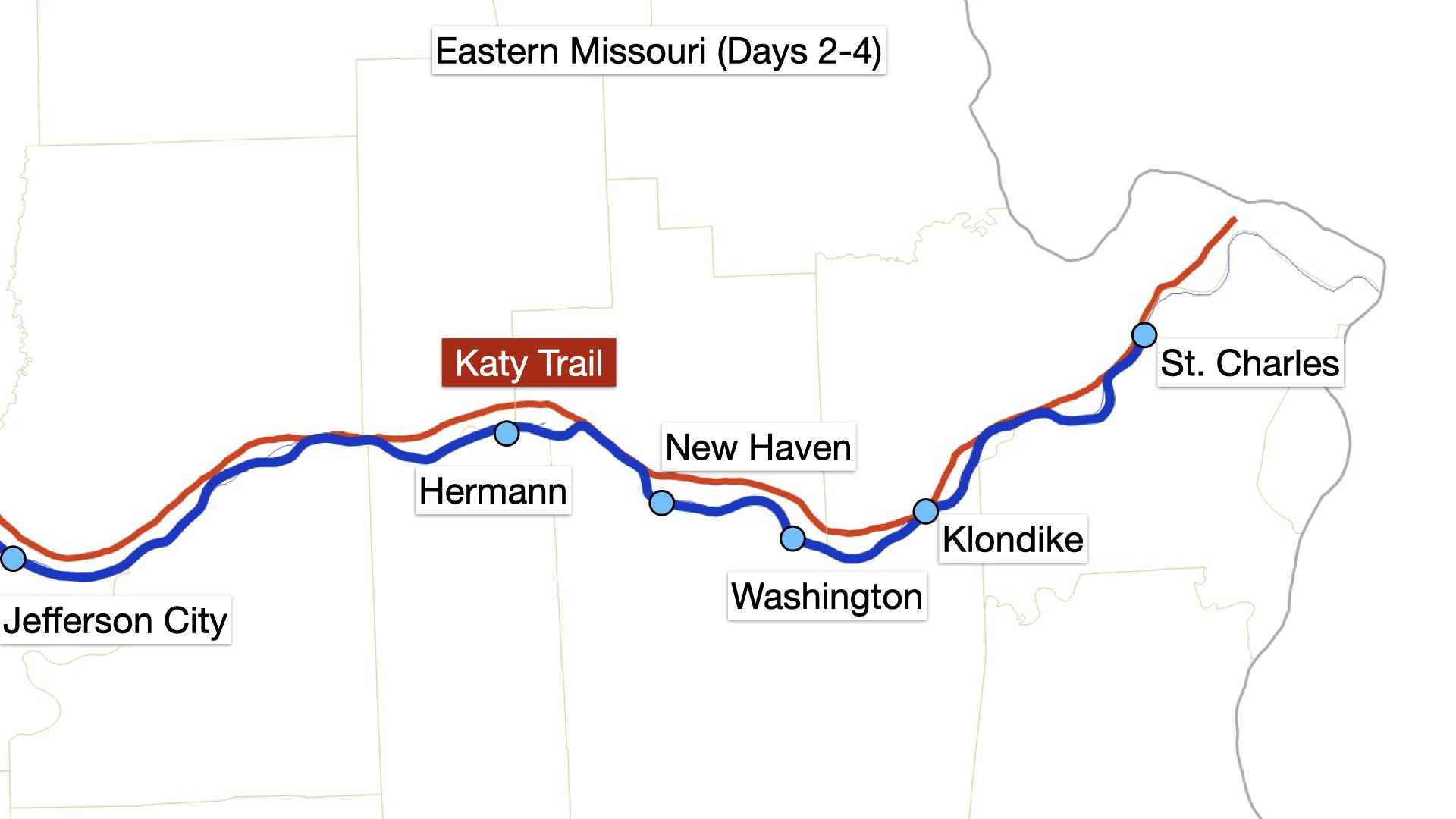

Racers in this section are far more spread out downriver of Jefferson City but can be seen over three days.
Day 2 offers the chance to see elite paddlers leading the race, but they will be fairly sporadic.
Day 3 will have the most steady flow of racers, though more widely distributed than to the west.
Day 4 features the race’s tail sweeping eastward as paddlers push to beat the final cutoff that evening. Consult the official MR340 race map and time chart to assess where racers are likely to be.
Towns along this stretch have the best-developed riverfront parks with lots of room and infrastructure.
Riverside sections of the Katy Trail offer good viewing all the way to St. Charles.
Viewing guide by specific location

Kansas City
The downtown Kansas City riverfront offers extensive public space to watch the race’s launch. Be there on time as the race starts in two pulses from Kaw Point, just upriver, at 7:00 a.m. and 8:00 a.m. We recommend the Missouri River viewing deck accessed from the River Market district, which connects via riverfront trail to the extensive Berkley Riverfront park.
LaBenite Park
LaBenite Park has easy access, shade, extensive river frontage, and outhouses. The only downside here is that the navigation channel is on the far side of the river. Expect most racers to pass by between 8:30 and 10:30 a.m. on Day 1.

Cooley Lake Conservation Area
The boat ramp associated with this conservation area offers a rare river access on the north bank. There’s a great view, with the navigation channel on the ramp’s side of the river, but this site has no infrastructure and little shade. Expect most racers to pass by between 9:30 a.m. and 1:00 p.m. on Day 1.

Glasgow
Downtown Glasgow boasts an elevated riverside viewing platform that’s perfect for race-watching, with a nearby covered pavilion. Just downstream is another good spot, the city’s large riverside park, featuring a campground, boat ramp, and plenty of space.

Boonville
Boonville’s historic railroad bridge hosts a pedestrian platform out over the river with excellent views of racers passing by. The nearby highway bridge has a separate bike/pedestrian lane that provides views directly down onto the channel. The cross-state Katy Trail State Park rail trail crosses the river here; see our dedicated section below for more on watching the race via this trail.

Rocheport
This small town is a particularly popular stop along the Katy Trail. A half-mile walk southeast from the trailhead will get you to the first river views; the trail continues riverside for another mile beneath soaring limestone bluffs, with occasional benches. A half-mile walk to the west will take you to Rocheport’s famous tunnel, the only one along the 240-mile trail.

Eagle Bluffs Conservation Area
This conservation area is a major wildlife refuge with extensive bird-watching opportunities. A small riverside parking lot here offers good river views, though it’s closed in 2025 for construction. Visit the official site for maps and other information about this large area.

Cooper’s Landing
Cooper’s Landing is a popular riverside bar, music venue, and all-purpose hangout. It can be very busy during the race but is also a great place to watch the river, with cold drinks, food trucks, and lots going on. Visit their website to learn more. Parking can be limited in busy times, so consider riding here on the Katy Trail from another trailhead such as McBaine (a pleasant six-mile ride).

Jefferson City
Jefferson City hosts a boat ramp and park on the north bank, just upstream from the highway bridge. The newly developed Deborah Cooper park extends along the south bank, accessed by a pedestrian bridge from the capitol building grounds. The navigation channel is on the far side of the river here but it’s otherwise a lovely setting.

Hermann
Hermann is a vibrant river town with a beautiful and extensive riverfront park. The ramp here is busy but not crowded, and the park extends downriver with shade trees, pavilions, and facilities. This is a regional tourist destination with a visitor-oriented downtown celebrating the region’s German heritage.

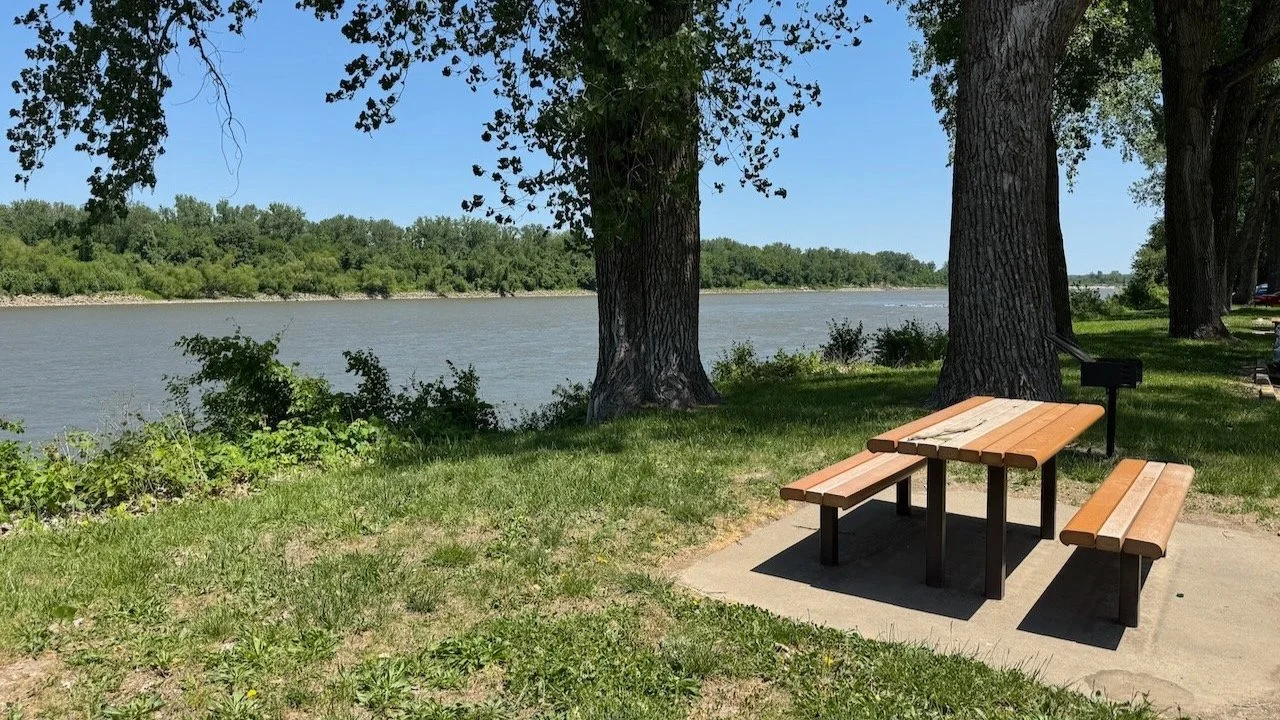
New Haven
New Haven is a small town with a long, shady riverfront park excellent for race-watching, as the navigation channel is close to the near bank. Riverside camping is an option here! The nearby Paddle Stop Brewery has strong ties to the race and is worth a visit, though it lacks a direct river view.
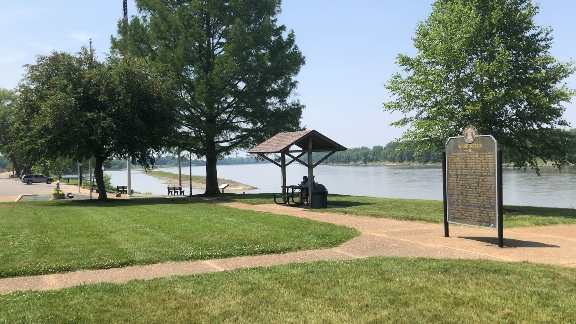
Washington
Washington is similar to Hermann, with another large riverfront park featuring shade, pavilions, and facilities. A paved walking/riding trail extends in both directions along the river. This setting also boasts a historic visitor-friendly historic downtown with shops and restaurants.

Klondike
Klondike Park’s setting includes a large historic sandstone quarry with shimmering white deposits of nearly pure quartz sand. Hike its trails up to an expansive blufftop overlook of the Missouri River valley, or go down to the nearby boat ramp to cheer on tired racers traversing this final stretch of the race.

St. Charles
St. Charles is the race’s terminus, featuring yet another expansive riverfront park. Join the crowds cheering on finishing racers as they push through the final strokes throughout Days 2–4. Just up the bank is a wonderfully preserved river town with historic architecture and lots of restaurants and shops.
Following the race via Katy Trail


The cross-state 240-mile Katy Trail State Park rail trail crosses the river at Boonville and follows the river valley for the rest of the race’s course, offing many riverside stretches with great race viewing.
A bike ride, or even a walk, along the Katy Trail is a great way to interact with the race. See our Katy Trail page for more on riding and appreciating the trail. BikeKatyTrail is another good resource.
The Missouri River valley is well over a mile wide and often lined with tall bedrock bluffs. The trail stays on the north side of the valley, but the river meanders within this corridor, meaning only certain stretches of trail have direct river views. Use a map to find sections where the river channel and trail are in close proximity. Particularly nice stretches include those between:
Following the race via Amtrak

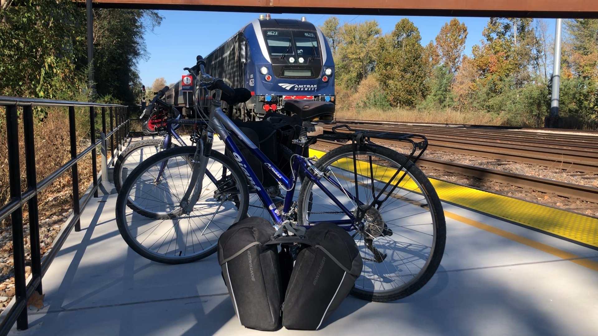

Another fun way to move around the race course is via train! Jefferson City, Hermann, and Washington all have twice-daily Amtrak service in both directions via the Missouri River Runner service, using depots a short walk from their riverfront parks. Learn more about using Amtrak from these towns in the Katy Trail portion of our site.
River Runner service is also bike-friendly, though you do need to reserve bike spots in advance. From these three towns on the south side of the river valley, it’s possible to connect to the Katy Trail along the north side. At Jefferson City this can be done by via a dedicated spur trail, while crossing at Hermann and Washington involve some road riding.
West of Jefferson City, the route turns inland to Kansas City. But that city’s Union Station is connected to the River Market district by a free streetcar, making it possible to catch the race’s start before heading downriver by train. Unfortunately, the downtown St. Louis station has no direct public transportation connections to St. Charles, though it’s possible to bridge the gap with some creativity (and a bike), as we demonstrate in one of our videos.